

Map of the reconstruction of Lisbon after the earthquake of 1755 The orientation is shown with a lily rose It contains the most important streets and...
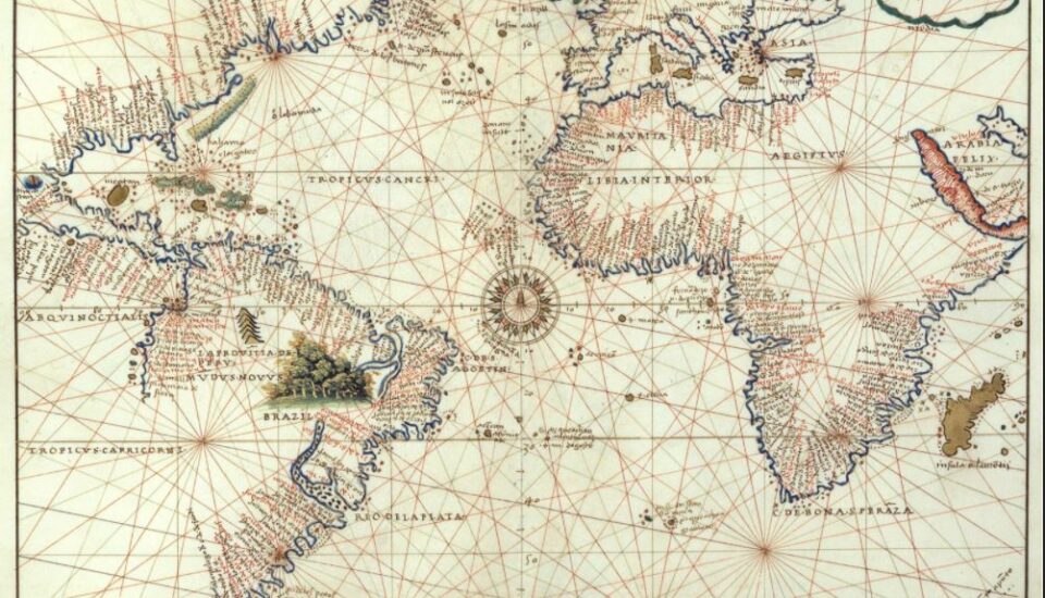
Map or nautical chart of the Atlantic at the height of 1544, detailing the maritime profile of Europe, Africa and America, made by Battista Agnese in 1544 The author's name and date appear on the map...
It is part of a petition and evidence of the cities of Guadalajara, Purificación, Zacatecas, mines of Tepeque (Bolaños), Etzatlán, Guachinango and Llanos de los Chichimecas (Lagos), on their...
Anonymous world map, probably made in the 18th...

