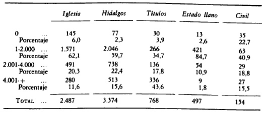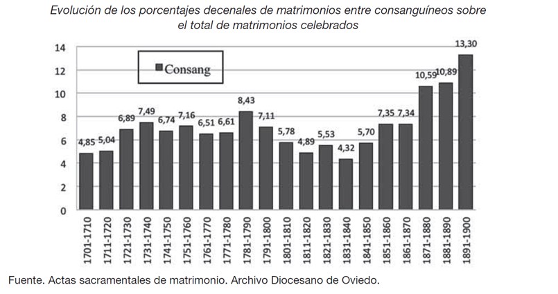
The Cadastre of the Marquis de la Ensenada, carried out in the middle of the 18th century, was a great impetus on the part of the government to increase fiscal and demographic control. Of all the areas concerned, such as professions, location, economic activities, number of inhabitants, churches, brotherhoods, and the surroundings of the municipalities, it is the latter which graphically revealed the context in which the households were settled.
This example of the village of El Ballestero, dependent as a hamlet on the town of Alcaraz during the Modern Age, had begun its urban configuration before its emancipation. In 1752 we see a total of 7 roads containing a total of 61 dwelling houses. The main areas of the town centre were located around the square and the church. The average size of all the buildings in El Ballestero ranged between 100 and 150 m2. The average household size was 3.6 tenants, and nuclear households accounted for 80% of the total.
Collection: Images
Project: 11. Science and culture as representation in Europe., 3. Rural world and urban world in the formation of the European identity.
Chronology: XVIII
Scope: Secondary Education, Baccalaureate, University
Resource type: Image
Format: Map
Source: Archivo Histórico Provincial de Albacete, Secc. Catastro del Marqués de la Ensenada, en: Hernández López, C. (2013). La casa en La Mancha oriental. Arquitectura, familia y sociedad rural (1650-1850). Madrid: Sílex, p. 424.
Language: Spanish
Date: 1752
Owner: Pablo Ballesta Fernández (Modernalia)
Copyright: ©Carmen Hernández López ©Sílex ediciones S.L. © Archivo Histórico Provincial de Albacete
Abstract: Planimetry. Map of El Ballestero according to the representation of the Cadastre of the Marqués de la Ensenada (1752).
Tags


