

Map of the Iberian Peninsula, made by Sebastian Münster and first published in 1544 (Basel). Publisher Henri Petri

0. What is Europe? The European Spaces in the history of Europe.
Universal atlas, broken down into 27 maps referring to continents and powers of the time, composed by Tomás López and published in Madrid in 1792
Geographical Atlas of the Kingdom of Spain, and Adjacent Islands, and Portugal, first published by Tomás López in 1757. This edition corresponds to the third and last edition of this work, published in Madrid in 1792
Geographical atlas of Spain divided into kingdoms and provinces and composed by the sons of Tomás López in 1804 from different editions of the maps published by Tomás López during his lifetime
Geographical map of the Iberian Peninsula, with the division of Portugal and Spain, and the internal royal divisions, by Tomás López, which forms part of the Geographical Atlas of Spain published by the author’s sons in 1804, compiling various cartographic works by his father.
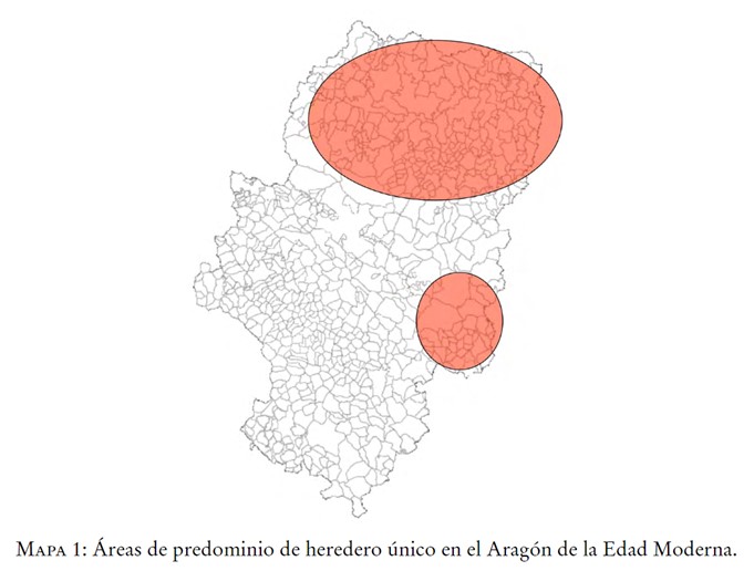
Map showing the greater implementation of the family policy of the sole heir in the Kingdom of Aragon during the Modern Age, as opposed to the egalitarian distribution of inheritance
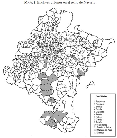
Map showing the main population centres in the kingdom of Navarre during the Modern Age; cities that were the main protagonists of greater conflict in comparison with the rural world
Illustration of the municipality of Jabrique (Malaga) in the 18th century
Cartography of the Peñón de Vélez de la Gomera in 1790
Map of Navarre with the lay lordships with jurisdiction in the 15th century indicated
Page 5 of 6

