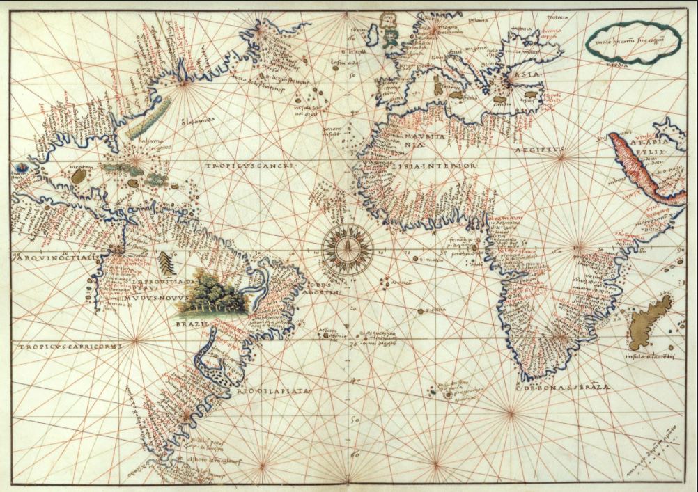
Map or nautical chart of the Atlantic at the height of 1544, detailing the maritime profile of Europe, Africa and America, made by Battista Agnese in 1544. The author’s name and date appear on the map n÷o± 9, folio 12 at the top: “baptista agnese fecit venetijs 1544 die primo Julij”
Cartografía Histórica
Map of the reconstruction of Lisbon after the earthquake of 1755. The orientation is shown with a lily rose. It contains the most important streets and buildings
Geographical atlas of Spain divided into kingdoms and provinces and composed by the sons of Tomás López in 1804 from different editions of the maps published by Tomás López during his lifetime
Geographical map of the Iberian Peninsula, with the division of Portugal and Spain, and the internal royal divisions, by Tomás López, which forms part of the Geographical Atlas of Spain published by the author’s sons in 1804, compiling various cartographic works by his father.
Geographical map of New Spain, in present-day Mexico. Factitious title taken from another manuscript copy of Humboldt’s original: “Carta geográfica general del reino de Nueva España, sacada de la original hecha en 1803 por el Sor. Baron de Humboldt and dedicated to the Count of Valenciana. It is one of the contemporary manuscript copies made of Humboldt’s original in Mexico City in 1804.
Reproduction made in 1992 of the Universal Letter handwritten by Juan de la Cosa in 1500, on the occasion of the V Centenary of the Discovery of America, which is kept in the Naval Museum of Madrid (Sign. 257). Edition of 2,000 copies.
Anonymous world map, probably made in the 18th century
It is part of a petition and evidence of the cities of Guadalajara, Purificación, Zacatecas, mines of Tepeque (Bolaños), Etzatlán, Guachinango and Llanos de los Chichimecas (Lagos), on their behalf and on behalf of the conquerors and settlers of New Galicia presented before the oidor and visitador general Hernando Martínez de la Marcha on 10 January 1550 requesting the transfer of the seat of the diocese and the Audiencia from the city of Compostela to that of Guadalajara.
Map of the Iberian Peninsula, made by Iudocus Hondius (author) and Petrus Kaerius (engraver), based on Mercator’s Atlas sive Cosmographicae Mediationes de Fabrica mundi et fabricati figura (1595), where this map, which Mercator had not drawn, was added, in any case following his style in the aforementioned work. Published in Amsterdam, c. 1606.
Map of the Iberian Peninsula, made by Johann Baptist Homann from Jaillot’s geographical information. In the lower right-hand corner is the cartouche which is practically copied from Pierre Mortier’s “Theatre de la Guerre en Espagne et en Portugal” of 1705. Published in Nuremberg in 1720.


