
Map of the Iberian Peninsula, made by Sanson d’Abbeville (royal geographer of France), but edited by H. Laillot. Published in Paris in 1692.

Edad Moderna
Map of the Iberian Peninsula, made by Abraham Ortellius and first published in 1570 (Netherlands). This edition was edited by Aegidius Coppenius Diesth and published in Antwerp in 1584
Map of the Iberian Peninsula, made by Sebastian Münster and first published in 1544 (Basel). Publisher Henri Petri
Universal atlas, broken down into 27 maps referring to continents and powers of the time, composed by Tomás López and published in Madrid in 1792
Geographical Atlas of the Kingdom of Spain, and Adjacent Islands, and Portugal, first published by Tomás López in 1757. This edition corresponds to the third and last edition of this work, published in Madrid in 1792
Map of the kingdom of Navarre in the 17th century.
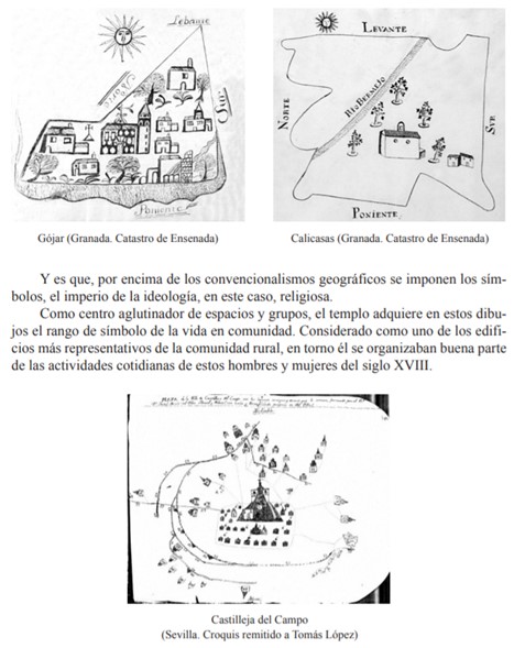
Resource showing the municipal representation highlighting the Church as a central element, reflecting the religious mentality expressed in local symbols
Division into archdioceses, dioceses, archpriestships and parishes in Spain
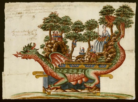
Everyday life, celebrations and religious festivities. The image shows the representation of a Tarasca from the Corpus Christi procession
Everyday life, celebrations and religious festivities. The image shows a Tarasca for the Corpus Christi procession of 1744 in Madrid
Page 2 of 6

