
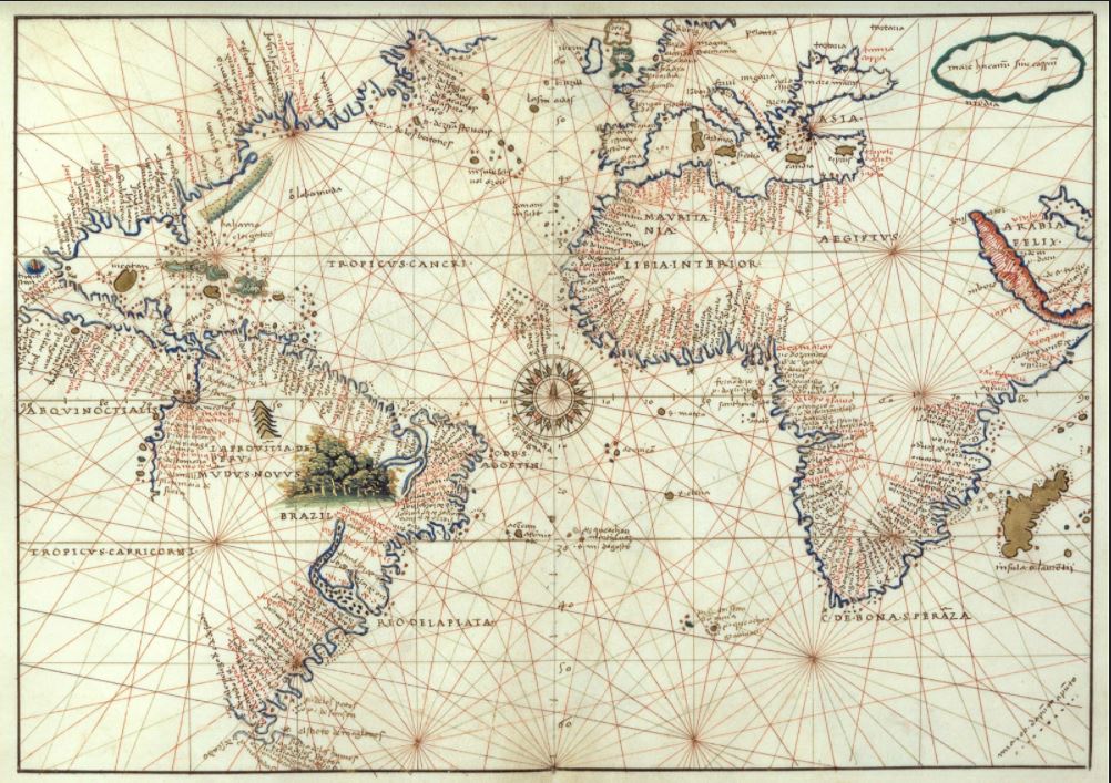
Map or nautical chart of the Atlantic at the height of 1544, detailing the maritime profile of Europe, Africa and America, made by Battista Agnese in 1544. The author’s name and date appear on the map n÷o± 9, folio 12 at the top: “baptista agnese fecit venetijs 1544 die primo Julij”

Mapas antiguos
Map of the reconstruction of Lisbon after the earthquake of 1755. The orientation is shown with a lily rose. It contains the most important streets and buildings
Map of the Iberian Peninsula, made by Sanson d’Abbeville (royal geographer of France), but edited by H. Laillot. Published in Paris in 1692.
Map of the Iberian Peninsula, made by Abraham Ortellius and first published in 1570 (Netherlands). This edition was edited by Aegidius Coppenius Diesth and published in Antwerp in 1584
Map of the Iberian Peninsula, made by Sebastian Münster and first published in 1544 (Basel). Publisher Henri Petri
Universal atlas, broken down into 27 maps referring to continents and powers of the time, composed by Tomás López and published in Madrid in 1792
Geographical Atlas of the Kingdom of Spain, and Adjacent Islands, and Portugal, first published by Tomás López in 1757. This edition corresponds to the third and last edition of this work, published in Madrid in 1792
Geographical atlas of Spain divided into kingdoms and provinces and composed by the sons of Tomás López in 1804 from different editions of the maps published by Tomás López during his lifetime
Geographical map of the Iberian Peninsula, with the division of Portugal and Spain, and the internal royal divisions, by Tomás López, which forms part of the Geographical Atlas of Spain published by the author’s sons in 1804, compiling various cartographic works by his father.
Geographical map of New Spain, in present-day Mexico. Factitious title taken from another manuscript copy of Humboldt’s original: “Carta geográfica general del reino de Nueva España, sacada de la original hecha en 1803 por el Sor. Baron de Humboldt and dedicated to the Count of Valenciana. It is one of the contemporary manuscript copies made of Humboldt’s original in Mexico City in 1804.
12
Page 1 of 2

