Map of Navarre with the lay lordships with jurisdiction in the 15th century indicated
Navarra
Map of the kingdom of Navarre in the 17th century.
Participation of socio-professional groups in Navarre’s institutions in the 18th century
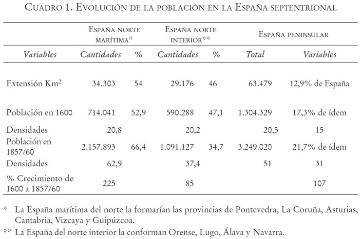
Table showing the uneven population growth in northern Spain between 1600 and 1857, distinguishing between the coastal provinces and the northern inland provinces
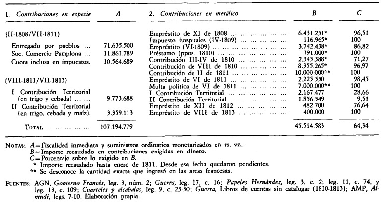
Contributions in cash or in kind to finance the Navarrese armies during the Napoleonic invasion
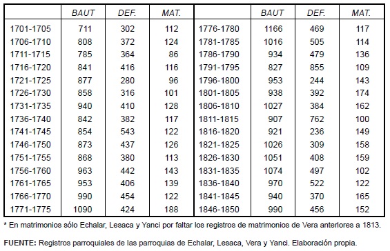
Evolution of adult baptisms, deaths and marriages in the Cinco Villas of Navarre between 1701 and 1850
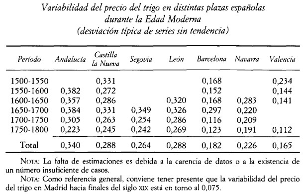
Evolution of the behaviour of the price of wheat in the regional markets of Spain during the Modern Age that affected the standard of living of families
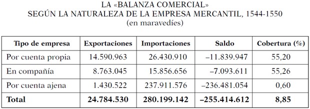
A resource that reflects the economic nature of the port of Bilbao, which is a major importer of raw materials and products, with a high incidence of commercial companies working for others
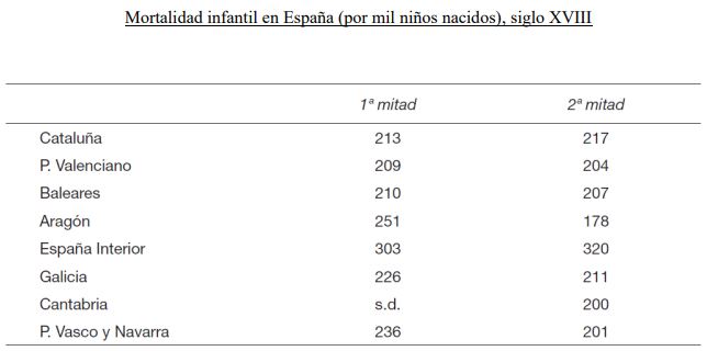
Regional differences in Spanish infant mortality in the 18th century
Episode 10 of the documentary series Memory of Spain: The Monarchy of the Catholic Monarchs.

