

Map of Navarre with the lay lordships with jurisdiction in the 15th century indicated

3. Rural world and urban world in the formation of the European identity.
Map of the kingdom of Navarre in the 17th century.
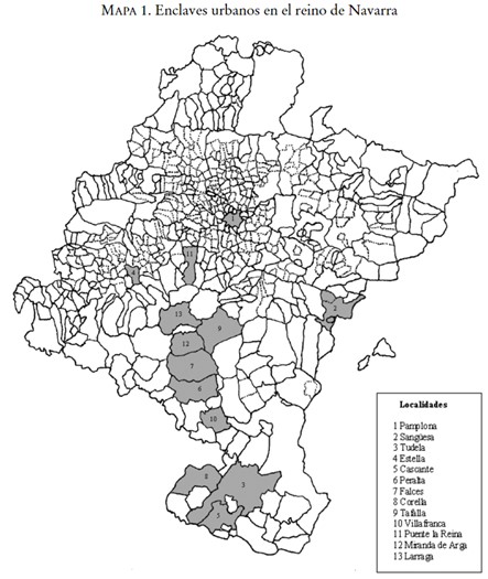
Map showing the main population centres in the kingdom of Navarre during the Modern Age; cities that were the main protagonists of greater conflict in comparison with the rural world
Illustration of the municipality of Jabrique (Malaga) in the 18th century
Cartography of the Peñón de Vélez de la Gomera in 1790
Fortifications proposed by Zermeño for Pamplona in 1756
Areas of port grouping under the jurisdiction of foreign consuls between 1679 and 1699
Plan showing the differentiated areas of Alicante Castle and its fortifications in 1709
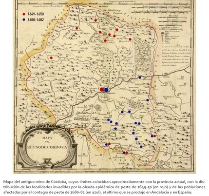
Map showing the distribution of plague in the former Kingdom of Cordoba during the 17th century
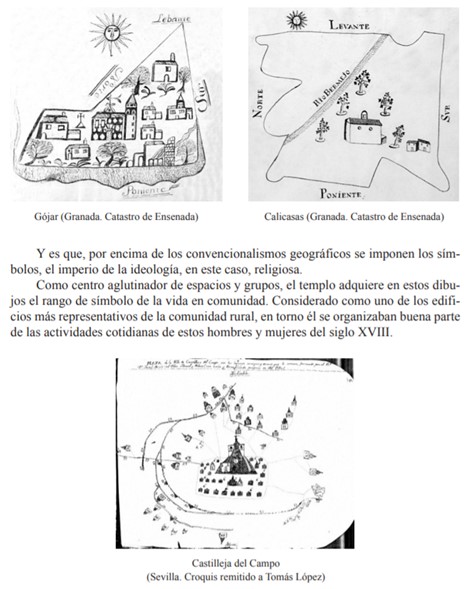
Resource showing the municipal representation highlighting the Church as a central element, reflecting the religious mentality expressed in local symbols
Page 18 of 58

