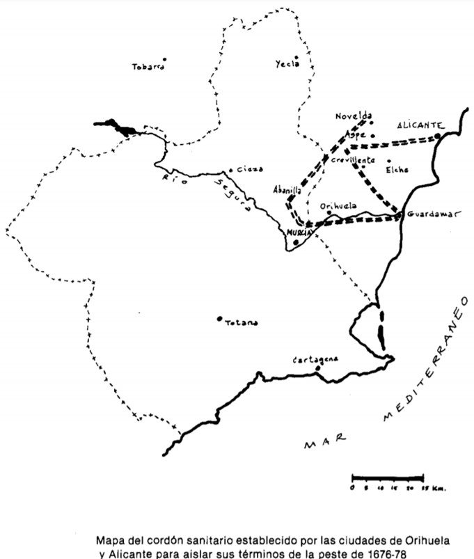
Map showing the cordon sanitaire between Orihuela and Alicante to prevent these cities from becoming infected by the plague at the end of the 17th century
Demografía Histórica
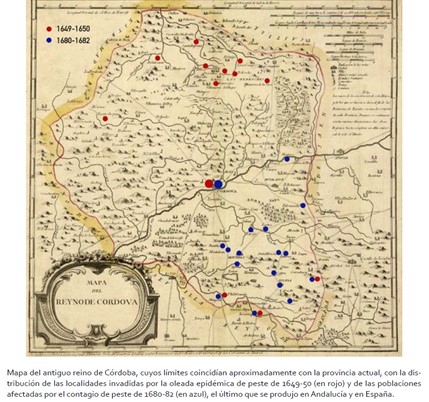
Map showing the distribution of plague in the former Kingdom of Cordoba during the 17th century
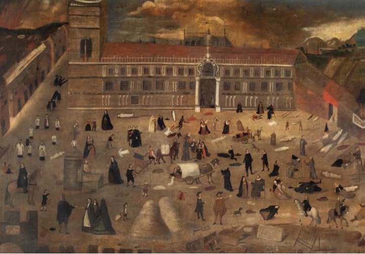
Painting depicting the scourge of the plague in the city of Seville in 1649
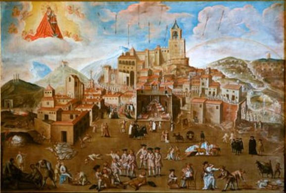
The resource shows the representation of the plague in Antequera in 1679 according to the religious mentality of the time
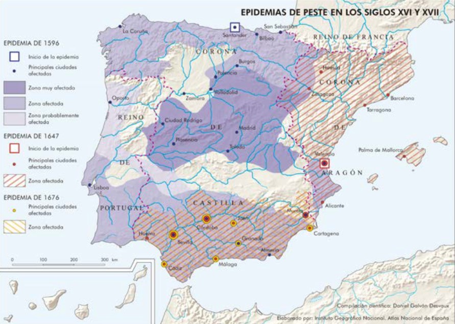
Resource showing the extent of the different epidemic waves of plague in the Iberian Peninsula during the 16th and 17th centuries
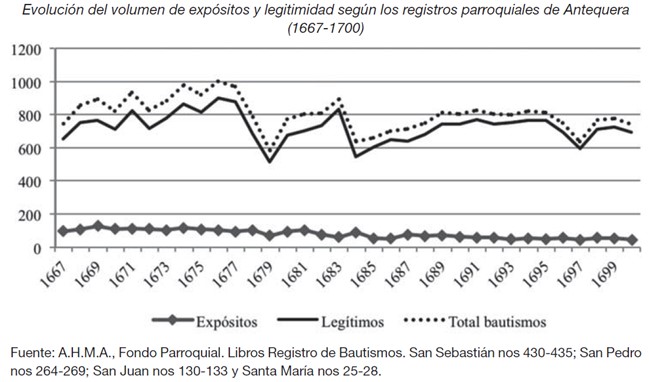
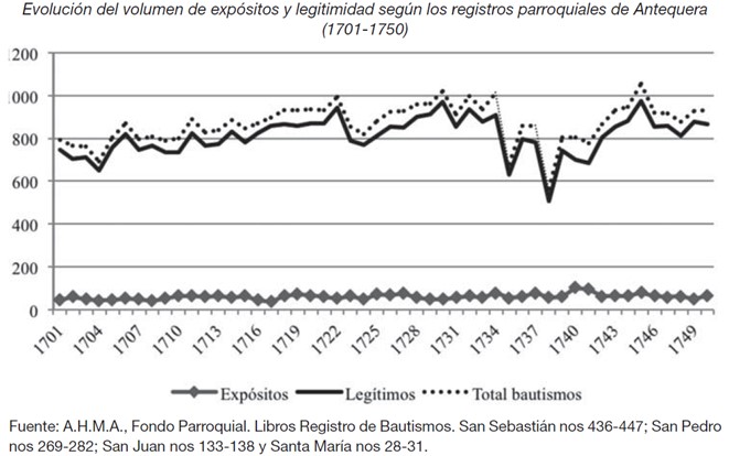
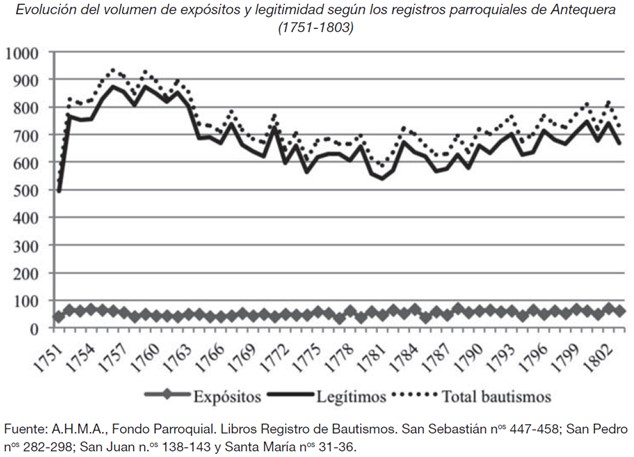
Graph showing the total number of births, legitimate children and foundlings according to the parish registers of Antequera
Graph showing the total number of births, legitimate children and foundlings according to the parish registers of Antequera
Graph showing the total number of births, legitimate children and foundlings according to the parish registers of Antequera
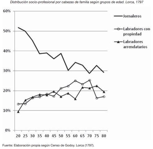
Graph showing social mobility within the peasantry of Lorca (Murcia) at the end of the Ancient Regime.
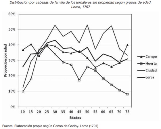
Resource that analyses the life cycle and social mobility of day labourers without property according to the space of agricultural activity.

