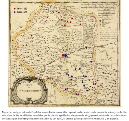
Map showing the distribution of plague in the former Kingdom of Cordoba during the 17th century
Epidemias
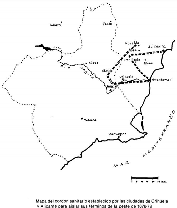
Map showing the cordon sanitaire between Orihuela and Alicante to prevent these cities from becoming infected by the plague at the end of the 17th century
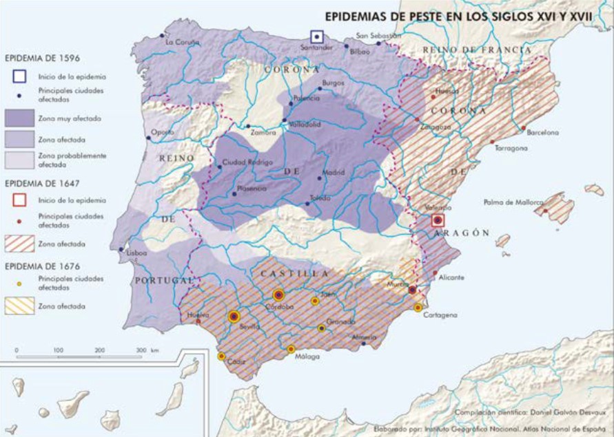
Resource showing the extent of the different epidemic waves of plague in the Iberian Peninsula during the 16th and 17th centuries
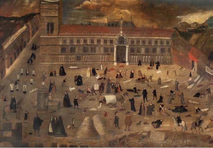
Painting depicting the scourge of the plague in the city of Seville in 1649
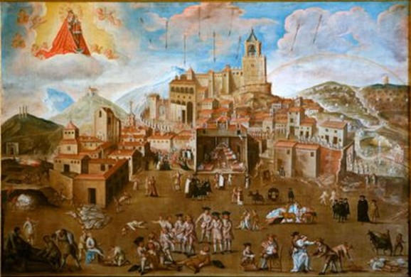
The resource shows the representation of the plague in Antequera in 1679 according to the religious mentality of the time
Graph showing the evolution of mortality, birth rate and marriage rate in Hoyos to reflect the changes that took place around the War of Independence in 1808
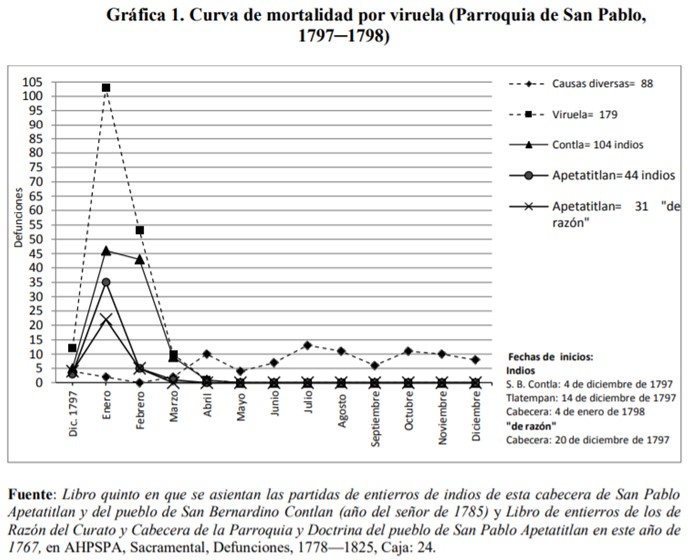
Resource showing the last indications of smallpox in New Spain through the parish of San Pablo Apetatitlan. America, like other continents, was also affected by this epidemic
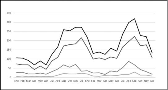
Distribution of annual deaths showing peak mortality due to epidemics
Explanatory video of the first session of the subject “The 17th century”, Geography and History, 2nd year of ESO.
Channel of the Permanent Seminar of Historical Dissemination “The Archive of Time”.

