
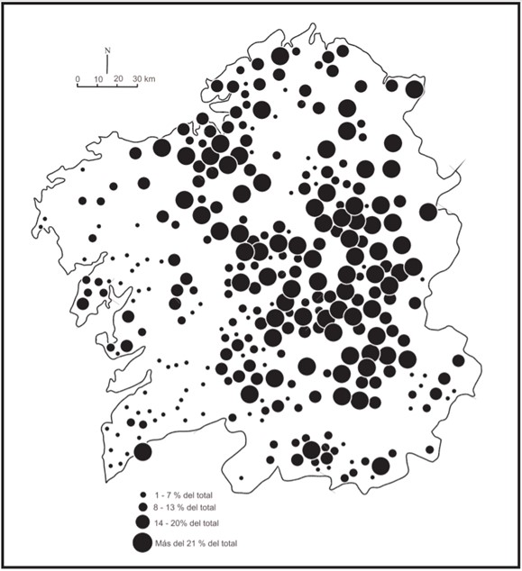
Map showing the distribution of households with servants in Galicia in the mid-18th century

Galicia
The table shows the population density of various Galician provinces, as well as their cultivated hectares and head of cattle per inhabitant in 1752
Military expenditure in Galicia between 1606 and 1640
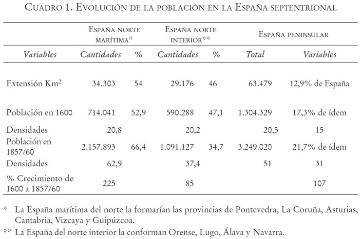
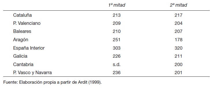
Table showing the uneven population growth in northern Spain between 1600 and 1857, distinguishing between the coastal provinces and the northern inland provinces
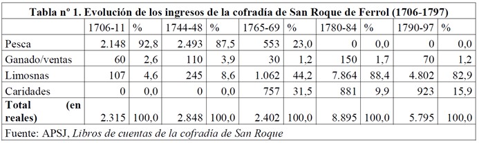
Resource showing the evolution of a guild from a guild to a devotional confraternity through income
Life expectancy in the different Spanish provinces during the second half of the 18th century
Infant mortality in the different Spanish provinces during the 18th century
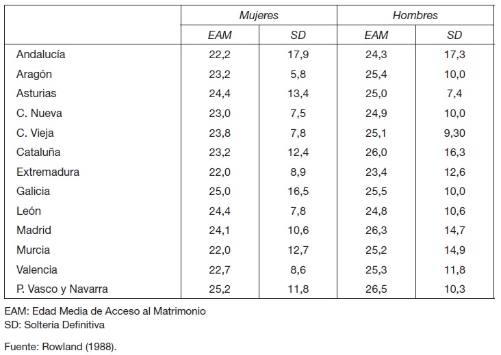
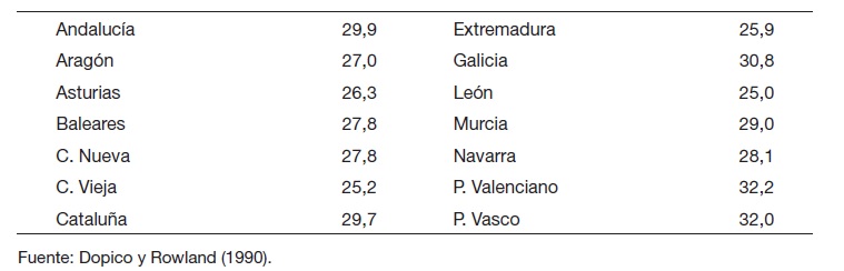
Estimated nuptiality in Spain from the 1787 census
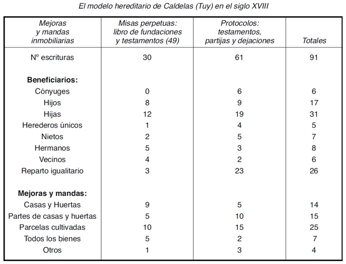
Statistical table analysing the transmission of wealth through inheritance, highlighting the egalitarianism of testamentary mandates. Caldelas, Galicia, in the 18th century
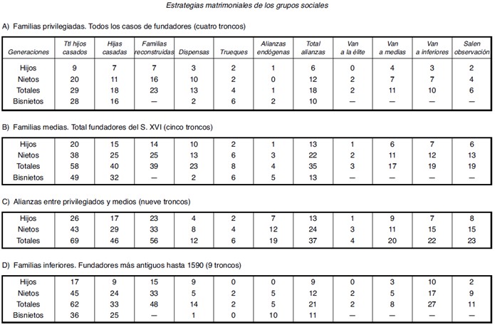
Table of social mobility at the end of the 17th century in Caldelas (Galicia) according to the marriage strategies of the different social groups
12
Page 1 of 2

