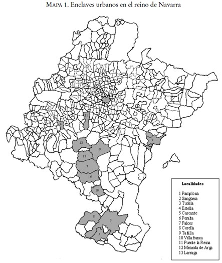
Map showing the main population centres in the kingdom of Navarre during the Modern Age; cities that were the main protagonists of greater conflict in comparison with the rural world
Mundo Rural
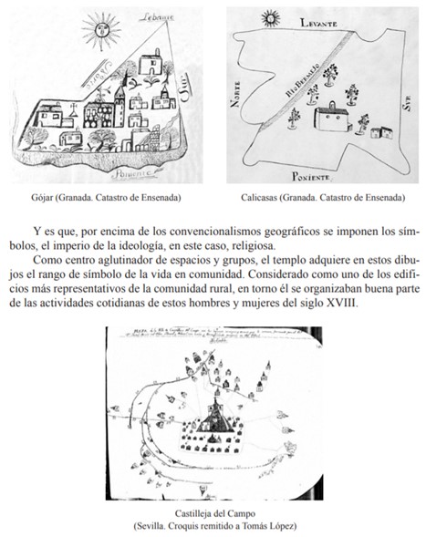
Resource showing the municipal representation highlighting the Church as a central element, reflecting the religious mentality expressed in local symbols
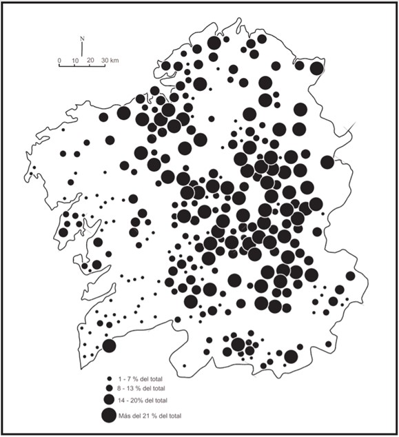
Map showing the distribution of households with servants in Galicia in the mid-18th century
Map of the ports of the Kingdom of Valencia between 1250 and 1520.
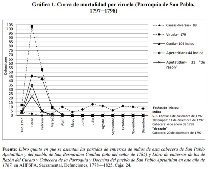
Resource showing the last indications of smallpox in New Spain through the parish of San Pablo Apetatitlan. America, like other continents, was also affected by this epidemic
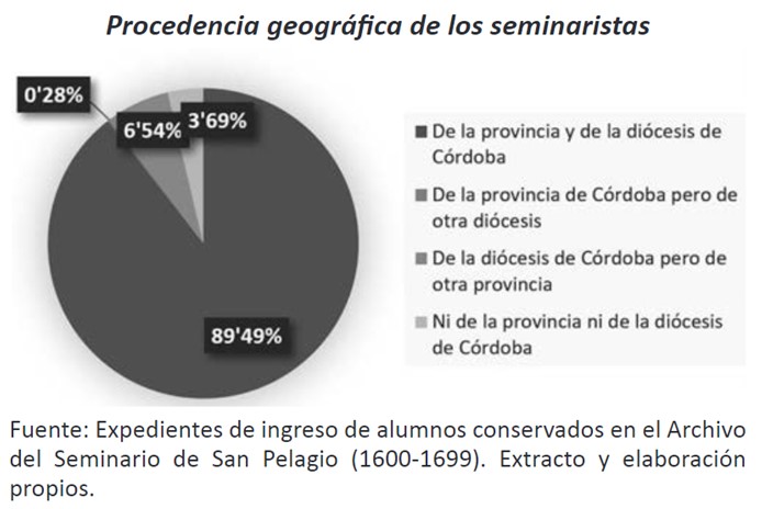
Resource showing the origin of the students of the Seminary of San Pelagio in Cordoba between 1600 and 1699, a seminary created in the heat of the Council of Trent and not exempt from conflict due to economic and institutional interests
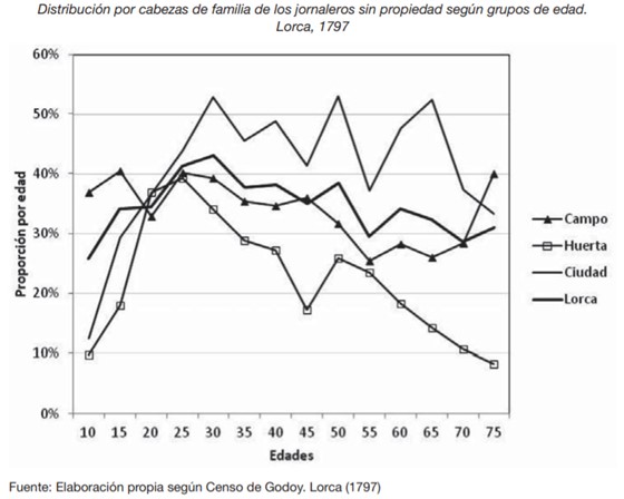
Resource that analyses the life cycle and social mobility of day labourers without property according to the space of agricultural activity.
Population growth in an urban island environment. Population growth and density
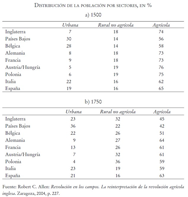
Table showing the evolution of urban, rural non-agricultural and agricultural population in the most important countries and communities of modern Europe
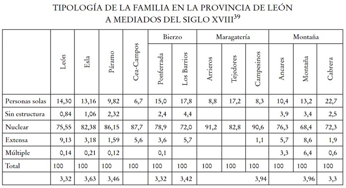
Table analysing the different family models in the province of León in the mid-18th century according to factors related to the geographical environment and the socio-economic structure

