The General Answers of the Cadastre of the Marquis de la Ensenada constitute the oldest and most exhaustive survey available on the towns of the Crown of Castile in the mid-18th century.
Hospitales
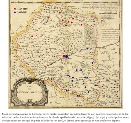
Map showing the distribution of plague in the former Kingdom of Cordoba during the 17th century
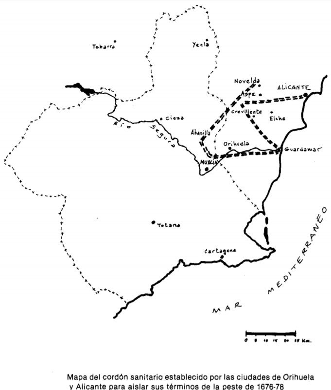
Map showing the cordon sanitaire between Orihuela and Alicante to prevent these cities from becoming infected by the plague at the end of the 17th century
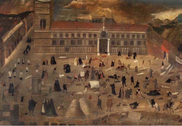
Painting depicting the scourge of the plague in the city of Seville in 1649
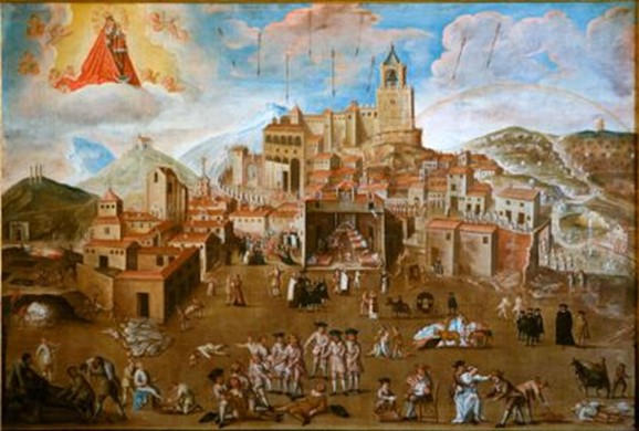
The resource shows the representation of the plague in Antequera in 1679 according to the religious mentality of the time
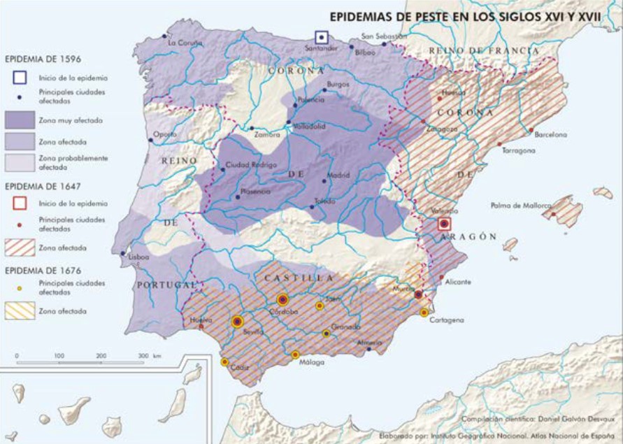
Resource showing the extent of the different epidemic waves of plague in the Iberian Peninsula during the 16th and 17th centuries
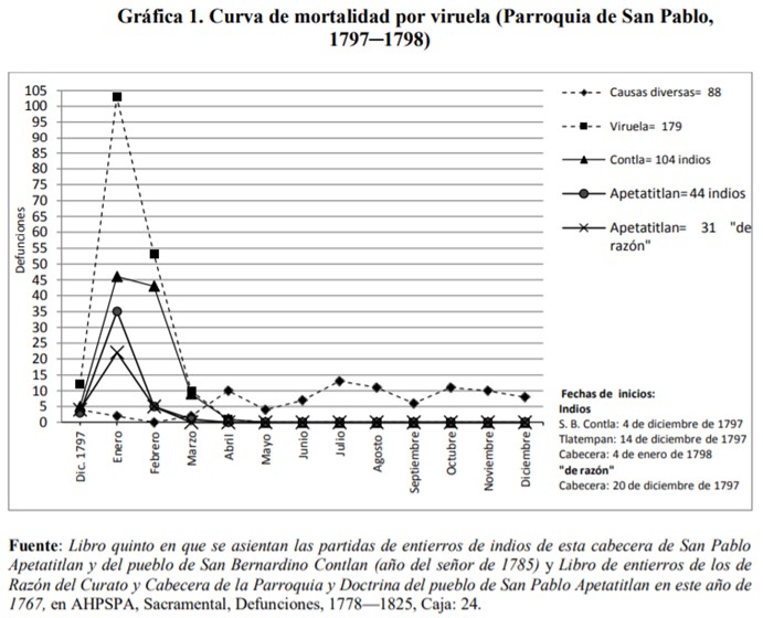
Resource showing the last indications of smallpox in New Spain through the parish of San Pablo Apetatitlan. America, like other continents, was also affected by this epidemic
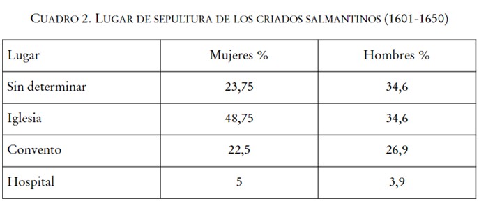
Table showing the preferred burial place of Salamancan servants, according to sex, between 1601 and 1650
Explanatory video on Balmis and the Philanthropic Smallpox Vaccine Expedition of 1803-1806
Audio about Balmis and the Philanthropic Smallpox Vaccine Expedition of 1803-1806

